
Tracing Spring Township Streets
Start with the exact situs address, meaning the parcel’s physical location, in the Berks County Property Records Search. Confirm that the municipality is Spring Township, because Sinking Spring, West Lawn, and Wyomissing are postal labels that can cross local boundaries. Save the parcel’s UPI, current owner field, site location, deed reference, and legal description. A UPI is the county parcel identification number. It ties the address to the map and to a recorded-document search more reliably than a road name alone.
- Enter the property address in the County search and record the municipality, UPI, site location, and deed reference shown on the current assessment record.
- Open Map Search or the GIS application, find the parcel on the street, and use the boundary view to confirm that the result sits on the intended lot.
- Use the UPI, property address, municipality, and legal description in the Recorder’s advanced index to locate recorded deeds, plans, liens, or other instruments.
- For a lawful civic-record question, ask Berks Election Services whether a specialized street listing is available for the permitted geography and use.
- For an older address, compare dated directory and telephone material with the parcel and deed trail instead of treating a current owner field as historic proof.
That sequence yields an address-based record trail, not an automatic list of every person at a house. The assessment record establishes current ownership and parcel details. A deed establishes parties to a recorded transaction. A historical listing can be a useful dated clue, but each source answers a different question.
Spring Township Address Search Fields
The replacement County property system has Basic Search and Map Search entry points for owner, street address, and parcel ID. Its detailed street form separates a number, direction, street, and ZIP Code. A broad road search can omit the number and then sort results by Location. The County advises simplifying a street suffix and omitting periods when an address does not match. Results are current assessment material, so capture the displayed source date when a record will be compared with older documents.
| County field or mode | Use for a street search | Important limit |
|---|---|---|
| Owner | Find a current assessed owner connected to a parcel. | An owner is not necessarily the current occupant. |
| Address Number, Direction, Street | Build a normalized situs-address query. | Road abbreviations and direction matter. |
| ZIP Code | Narrow a geographic candidate set. | Confirm Spring Township in the municipality field. |
| Parcel ID | Carry one parcel from the property card to the Recorder. | Parcel numbering can change after subdivision work. |
| Map Search | See parcel placement and adjoining geometry. | The map itself is not an owner roster. |
The property card can show owner and mailing fields, sales and deed references, tax district, assessment values, plan or lot references, and map tabs. A mailing address is where tax correspondence goes. It may belong to an owner, company, fiduciary, or post-office box, so it should never be relabeled as proof of residence.
Note: The former assessment parcel tools were scheduled for retirement in 2025, so use the current Property Records Search rather than saved legacy instructions.
Mapping a Spring Township Street
The Berks Mapping Office routes the public to GIS applications, tax maps, parcel resources, and the Data Hub. Tax maps show parcel boundaries, help assign a PIN, and provide assessment acreage. They do not print owner names on hard-copy sheets because ownership changes too often. Use a map to identify the correct parcel, then return to the property record for the owner field and the Recorder for document history.
The County map search also has a buffer tool with Distance, Units, Parcel, Center Points, and Polygons modes. For a short segment of a Spring Township street, choose a modest parcel buffer, note the resulting UPIs and site locations, then check each card separately. That protects against claiming that adjacent geometry proves a household connection.
The County Mapping page is the source for this GIS and parcel-resource view.
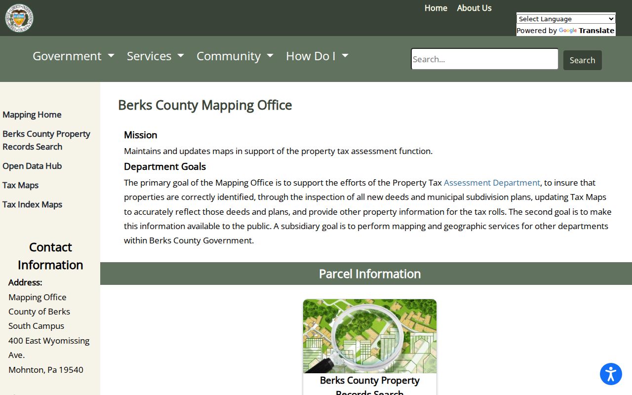
The mapping landing page is a starting point for parcel navigation, while the assessment card supplies the current ownership fields needed to interpret a street result.
Spring Township Street Deed Trails
The Berks Recorder Advanced Search accepts Party Names, Grantor, Grantee, a recorded-date range, document number, document type, volume, book and page, OCR text, parcel ID, municipality, and property address. Enter a party name as LASTNAME FIRSTNAME. Parcel IDs use 14 to 17 digits without dashes. Search Spring Township as the municipality instead of relying only on a city name, then compare the legal description, plan or lot, and parcel information before treating a document as the same property.
| Recorded-document field | Why it helps on a street |
|---|---|
| Grantor and grantee | Identify the parties who transferred or received an interest. |
| Recorded date and document number | Place an instrument in time and retrieve it again. |
| Parcel ID, municipality, property address | Test whether the result belongs to the target parcel. |
| Book, page, plan, and legal description | Bridge older records that lack a modern street label. |
A grantor gives an interest; a grantee receives one. To move backward, locate the current acquisition deed, identify the seller, and search that seller as a grantee for the earlier acquisition. If an old record lacks a street address, use the legal description, subdivision, parcel ID, or book and page. Berks says its computerized image and index trail reaches to the County’s 1752 formation, but the office’s original books, microfilm, and counter service remain the fallback when an online query falls short.
The Recorder’s Advanced Search shows the fields used for an address, parcel, and party-based search.
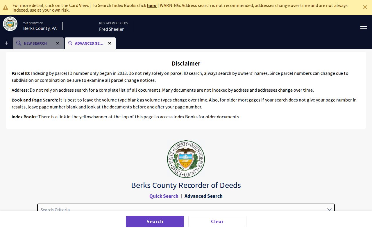
The address field is useful, but an older deed may require the parcel, party, plan, or legal-description route instead.
Spring Township Permit Addresses
Township permit and code material provides a separate address-history layer. The Spring Township permit page lists building, zoning, driveway, demolition, sewer, electrical, plumbing, deck, fence, pool, and other forms. A particular file may identify an owner or applicant, job site, project description, plans, contractor references, and issuance or inspection history. It is evidence about a project at an address, not a current-resident list.
No public address-result database was located for these files. Applications are not accepted by email. Use the listed form in person, by mail, or by fax, or submit a focused request for an existing file through the Township Open Records Officer. Right-to-Know requests can be delivered by email, fax, mail, or in person. A good request names the address, approximate date range, and record type. The officer can redact exempt information and does not have to create a new list.
Spring Township’s permit forms page shows the local categories available for address-specific requests.
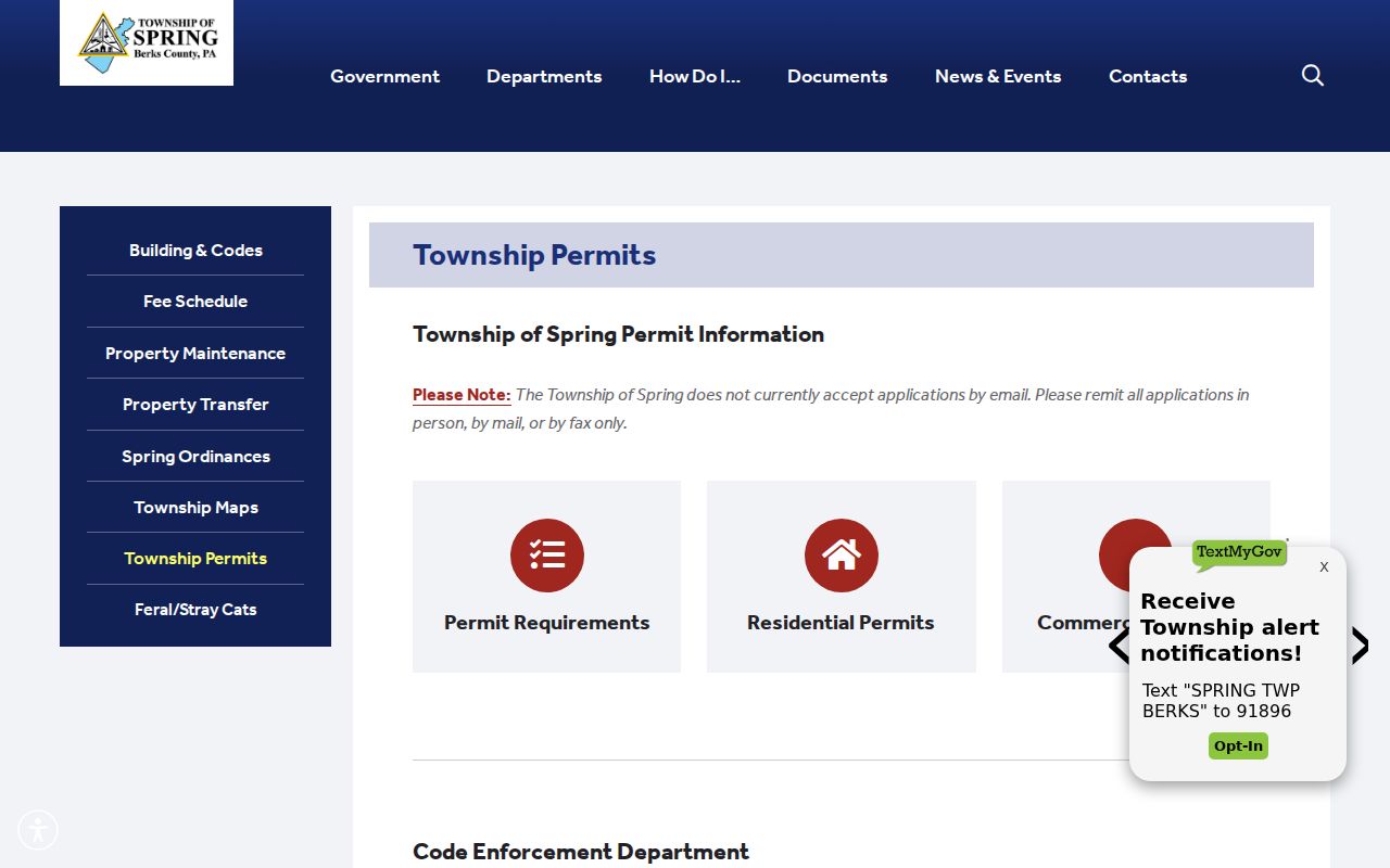
These forms show how a physical address and project details enter a Township file, which is different from the county ownership trail.
Spring Township Parcel Events
The County’s delinquent-tax search is another parcel-focused tool. It accepts one search criterion and recommends a parcel number without dashes, using 14 digits or 17 for mobile homes. Its location search calls for abbreviated suffixes such as St, Rd, Ln, Av, Cr, Bl, and Pi. A tax result belongs to the parcel and collection process. It does not establish who lives along a Spring Township street.
Property Transfer Ordinance 341, effective in 2007, adds a local inspection record before title transfer of certain dwellings. The inspection concerns visible zoning and property-maintenance conditions. A seller, buyer, or agent may apply. The Township identifies a standard 30-business-day lead time and a shorter expedited route, and it can retain an address-specific record of an inspection or correction certificate. That timing can help date a transfer-related condition without replacing the deed itself.
Berks Tax Claim’s parcel and location search is the source for the County delinquency route.
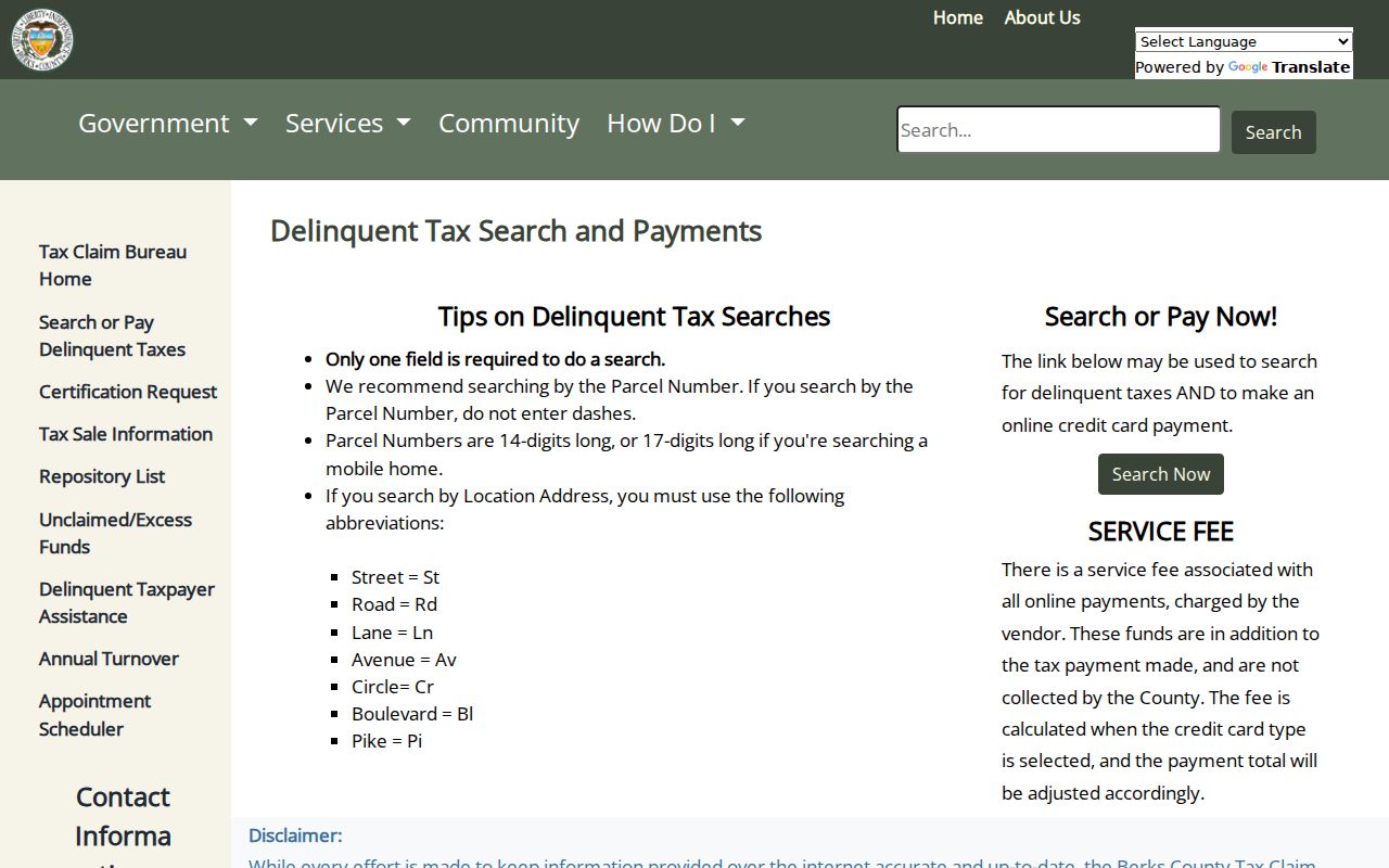
Use this search as a parcel-status lead, then confirm ownership and recorded history through the assessment and Recorder records.
Note: Assessment maintains parcel data, while Tax Claim handles delinquency questions, so owner, payer, and mailing fields should not be treated as identical evidence.
Spring Township Street Directory History
Historic street work has to follow the source’s own locality. Spring Township separated from Cumru Township in 1850, so a pre-1850 tract belongs under Cumru research. West Lawn was a borough before its 2006 merger into Spring Township. A correct old directory, newspaper, map, or deed can therefore use West Lawn, Cumru, Springmont, Reading/suburbs, Sinking Spring, or another period label rather than the current municipality filter.
NARA’s 1929 through 1933 Reading and suburb directory run specifically includes Springmont and West Lawn. The Library of Congress holds Reading telephone directories from 1911 through 1934 and Reading/Sinking Spring material for 1940 through 1948. Reading Public Library keeps archived city and suburban telephone directories, while Berks County Genealogical Society and Berks History Center offer additional dated local-history material. The historical collections themselves are described in the Spring Township city directory material.
- Parcel
- A defined piece of land tracked by the County with an identification number and mapped boundary.
- Situs address
- The physical location assigned to the parcel, distinct from a tax mailing destination.
- Plat or plan
- A recorded map or subdivision reference that helps match land when a street label changes.
- Criss-cross directory
- A historic reverse-style listing arranged by address rather than solely by name, when a specific volume provides it.
No complete official Spring Township criss-cross run was verified. A directory result should be cited to its exact volume and locality heading, then checked against the parcel or deed evidence for that time period.
Spring Township Voter Street Requests
Berks Election Services offers a public-information request route for specialized voter registration listings, street listings, labels, and electronic databases. The Pennsylvania self-service status tool is for the registrant, not a public browse-by-street record. For a permitted request, identify the geography, list type, format, date scope, and lawful reason or use, then ask the office what fields may be released and what protections apply.
Election law and confidentiality rules limit this channel. Protected addresses and identifying information are not a street-directory resource, and the Pennsylvania Address Confidentiality Program can use a substitute address for voter registration. A nonmatch, inactive registration, or omission does not prove that someone never lived at a Spring Township address. Election Services can be reached at 610-478-6490 for its current request procedure.
Spring Township Street Records
Street records work best as a chain of separate evidence. The County property card supplies the current parcel key. GIS shows boundaries and adjacent geometry. The Recorder supplies recorded documents. Township files can document a project or inspection, and dated directories can add historical context. These sources should be compared rather than merged into one unsupported claim about a household.
| Address layer | Local keeper | Useful return | Access route |
|---|---|---|---|
| Current parcel record | Berks Assessment | Owner, situs, mailing field, UPI, assessment and deed references. | Online search; Assessment counter or phone. |
| Parcel map | Berks Mapping | Boundary, PIN, map acreage, and parcel placement. | GIS applications, tax maps, appointment or phone inquiry. |
| Recorded instrument | Berks Recorder | Parties, date, instrument, legal description, and plan references. | Online index, web or counter copies, mail, phone, and historic media. |
| Permit or code file | Spring Township | Project, address, application, and inspection clues. | Forms, counter, mail, fax, or a written records request. |
| Voter street list | Berks Election Services | Only lawfully releasable voter-list information. | Specialized county or state request route. |
When online search fails, use the office that owns the record. Assessment and Mapping accept phone or counter inquiries. The Recorder offers online, counter, mail, telephone, original-book, and microfilm paths. A focused Township request can seek an existing administrative or permit file. State Archives, Reading Public Library, Berks County Genealogical Society, and Berks History Center provide historic fallbacks.
Spring Township Street Directory Limits
A street directory cannot establish every person at an address. Assessment records concern ownership and taxation. A deed records a transaction. GIS maps are geometry tools. Permit files concern a project, and a voter request is controlled by election law. Utility accounts, delivery information, DMV personal data, protected addresses, and complete household membership are not an open street-search layer. Use the evidence only for a specific, lawful personal question and preserve the distinction between an owner, an applicant, a recorded party, and a resident.
Lawful use. Spring Township address records are for personal, lawful research. Using public information to stalk, harass, threaten, or intimidate another person is prohibited under Pennsylvania law.